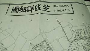
◆天保8年(1837)◆江戸時代地図帳の最高傑作◆国郡全図 若狭国(福井県)◆スキャニング画像データ◆古地図CD◆京極堂オリジナル◆
Seller: xggg57
| Domestic Shipping (Japan) Paid By: The shipping mentioned here pertains to the delivery from the seller to the BuyJapon warehouse. You will still be responsible for the shipping fee to have the package sent from the BuyJapon warehouse to your address. | Buyer |
|---|---|
| Early Finish: If this option is set to "Yes," the seller has the ability to end the auction before the scheduled closing time. The highest bidder at the moment of termination will be declared the winner. | Yes |
| Automatic Extension: If this option is set to "Yes," and a higher bid is placed within the last 5 minutes of the auction, the original ending time will be extended by an additional 5 minutes. This extension will occur each time the highest bid is updated. | No |
| Auction ID: | x1018799695 |
| Original Japanese name: | ◆天保8年(1837)◆江戸時代地図帳の最高傑作◆国郡全図 若狭国(福井県)◆スキャニング画像データ◆古地図CD◆京極堂オリジナル◆ |
| Japan Local Time: |
Item Description
Translation is provided as a convenience. You agree that you understand the original auction details written in Japanese and are fully responsible to bid on this item.

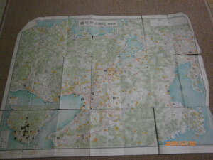
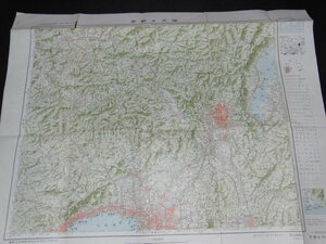
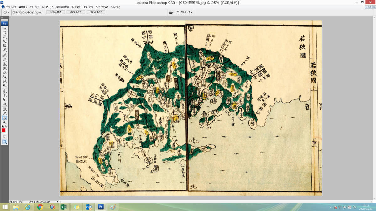
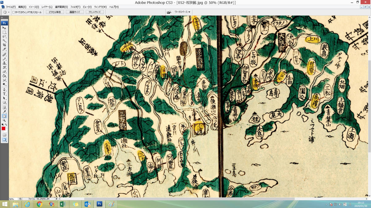
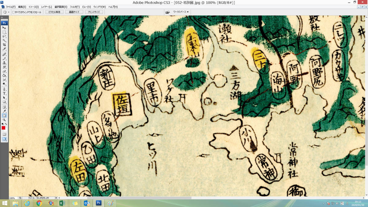
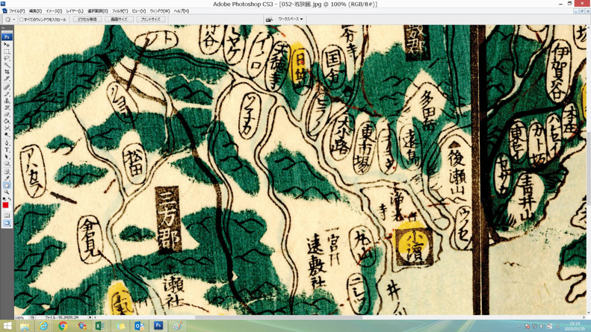
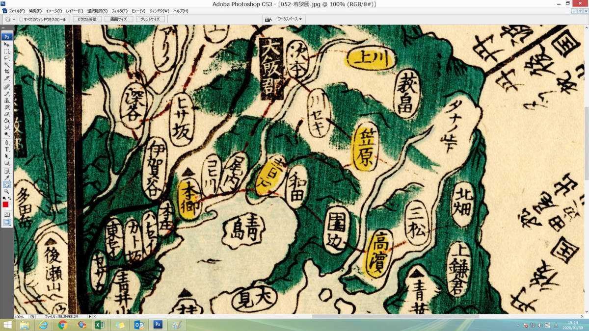
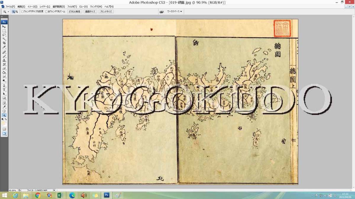
木版色刷 国郡全図 若狭国 スキャニング画像データ
江戸時代、文政11年(1828)識 天保8年(1837)刊の国郡全図より若狭国
記載地域
現在の福井県嶺南部
小浜市
三方郡,美浜町
大飯郡,高浜町,おおい町
三方上中郡,若狭町
遠敷郡
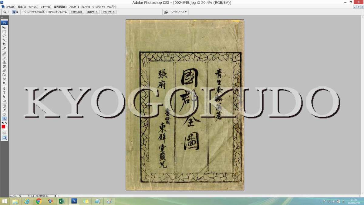
国郡全図
木版彩色5色
青生東谿 著
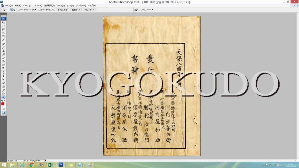
版元
大坂 河内屋和助
京都 勝村治右衛門
江戸 須原屋茂兵衛
尾張 永楽屋東四郎 他
文政11年(1828) 識
天保8年(1837) 刊
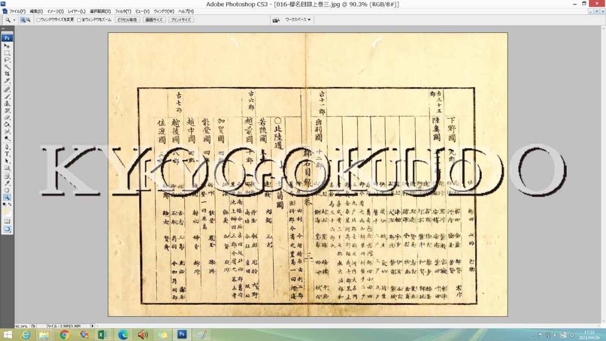
収録データ
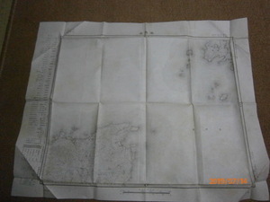
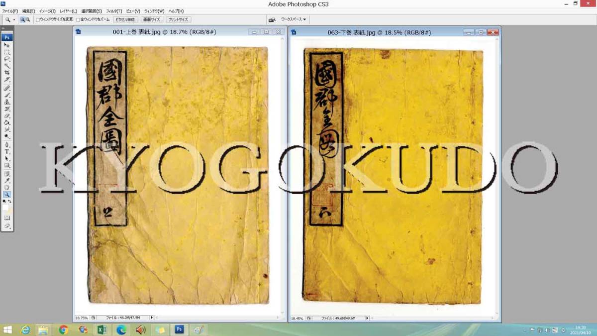
表紙 序 郡名目録 日本国総図 若狭国図 跋 奥付
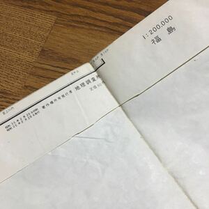
原寸:34×23 cm
画像:5360×3599 pixel
ファイルサイズ:5.86 MB
JPEG形式
高解像度400dpi
ディスクはUDFフォーマット
CD-R、不織布ケースにて、お送りします
見本画像は圧縮、縮小しています
商品の複製、譲渡、許可のない二次使用はご遠慮ください
サンプル画像内の文字は商品には入っていません
動作環境
MacOS10、Windows7 以上
Windowsフォトビューアー、Macプレビューなどで簡単に、ご覧いただけます
企画、製作、著作:紙久図屋 京極堂
古地図データは他にもあります。
リストはこちら 京極堂HP
落札後のキャンセル 返品には応じられません
不良品は、お取替え致します
複数落札の場合は一括発送させて頂きます。「まとめて取引」を選択してください
!!紙のオリジナルではありません。 スキャニング画像データです!!
他にも出品しています。 ↓マイ・オークションをごらんください↓


Similar Category Items